Tuesday, September 23, 2014

Roots, Rock, Reggae!

We pushed off from Truckee on August 30th. Today is September 5th, 3:30 in the morning, and I'm writing this sitting on a large granite boulder, looking far down onto highway 88 at Carson pass.  The occasional semi truck passes over it, the noise of it stirring up the quiet darkness.  The stars this morning are phenomenal.  This is a highway I've driven on.

Our trip in the northern Sierras started out of Donner pass and immediately climbed a beautiful ridge.


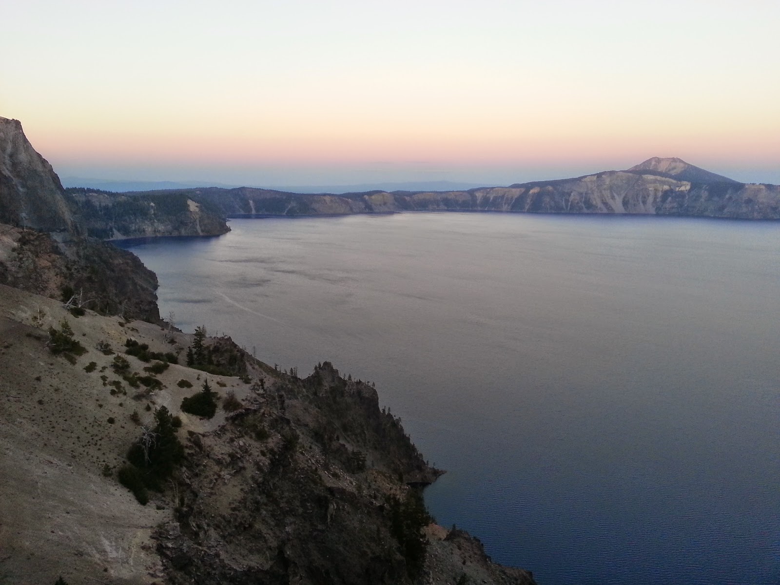
The trail was different then the last trail we set foot on in Oregon.  It was sad to be so displaced, to not gradually work our way to this fantastic scenery.  We weren't sad though, we were elated that day and the trail reminded  us of so many other places. We thought of Dinosaur, Colorado, and climbing Telescope Peak in Death Valley.


Here its dry and the sun is strong.  We made our way into the Granite Chief Wilderness.  The hills there were big and colorful.  There we met up with the Tahoe Rim Trail.  WE were up on another ridge gazing towards distant Tahoe, just relaxing for a long time in the morning sun.  Since getting to California we've had only beautiful days and only perfect weather.  Generally cool and breezy but the sun is always warm sometimes very hot! 


We don't see very many people anymore.  I think we have jumped ahead of most of the sobos and the nobos are all gone for the season.  Labor day has passed.  So its nice the people we do see we generally stop and talk to.  Even with what we skipped, it still feels like we've come far now and we're getting in really good shape.  We go up steep hills now without stopping.  Maggie's asthma is gone. We've been on the trail for over two months.


So we got up Baker Pass and could see the huge bare granite mountains of the Desolation Wilderness far in the distance. 


That night we camped at Richardson Lake and met 3 ladies who unloaded their snacks on us.  They gave us 10 cliff bars and nutella and fig bars and pay days!  Wow so nice, then we had our difficult day, walking 10 miles to Desolation.


WE eventually turned the corner out of the nicest dry forest to be confronted with Fontanellis Lake.  It was one of the lovliest lakes we've ever seen, sitting in a carved granite basin.


The water was still a little cold but the sun was hot and we got naked and swam.  WE washed ourselves well and felt completely relaxed for the next 10 miles of our day.


We then went over Dick's Pass and it was certainly one of the best views of our entire PCT trip so far. 


It was a rather grueling climb up to 9500 feet and we sat at the top for a long time looking at a few different lakes below us. 


We camped that night in a nice private spot at Gilmore Lake.


The next day we went into the heart of Desolation at Lake Aloha.  It was huge.  A huge alpine area of all pure white granite.  The basin looked like it had been scraped away by the glacier to leave this lake, speckled with islands. 


It was a great place to hang out.


That day our packs were light and we walked down to the Echo Lake resort.  Ww met a girl, Kim, on the trail and hiked back with her to her car and she gave us a ride to the post office in South Lake Tahoe.  WE got a 40$ motel room that night it was a nice treat.  We ate pizza and a huge tub of ice cream.  Getting back to the trial turned out to be easier than we thought...


In the morning we loaded our packs with food from the bargain market.  Then we walked down the street and a girl with gypsy clothes and half her head shaved asked us, "Hey, where you going?"  She looked about our age and we were promptly invited to her house, where she took us.  She lived in this beautiful cabin in the dry woods.  Her name was Greta and she was the apprentice to the acupuncturist in town.  She was a hippy witch doctor and shared with us all kinds of wonderful things.  Fruit especially, we ate like 5 pluots each and 2 nectarines and split up a gigantic watermelon.  Then the most incredible things, an elephants heart, which was like a dark red/orange plum that tasted rich and mysterious. Sweet and tangy with a blood orange flavor.  She gave us big stalks of aloe to rub on our skin.  She sat on the ground outside and while we were visiting was rubbing the aloe into the shaved side of her head.  She gave us iron supplements and B12 and elderberry syrup which was so delicious, and tea. 

After fortifying our health we went and got sandwiches, we met all her friends and her mom, and then she drove us back to the trail.  We made tons of friends in South Lake Tahoe, the same experience Maggie had the last time she was in this town.  The people here are the kind of people you become friends with instantly.    


In the morning with extremely heavy packs we hiked onward.  The trail was beautiful as ever.  We got one last glimpse of Tahoe as we crested a ridge, leaving the Tahoe Rim trail behind us.  Its been a favorite of our trip.  Then suddenly we were looking down to Carson Pass.  In January I took the scenic route home to Death Valley and drove this highway.  On that drive, right at the pass, I got out of the car and searched hard to find the PCT.  I hiked on it in the snow to a viewpoint and took a picture.  There it was, the photo I remembered, what an awesome feeling.  IT was the first place I've recognized since starting the trip.


As we crossed the highway we were given cherry tomatoes and watermelon which were perfect and we promptly finished them.  We came to camp not long after in this beautiful spot with a view.  Here we watched the sunset though our tent over the Carson Valley.  Our next stop is our beloved town of Bridgeport, getting my much needed pair of new shoes shipped there.  ITs going to be a few beautiful days though the Mokelumne Wilderness to get there, looking forward to it!


Tuesday, September 9, 2014

Midnight Train to Sacramento

We woke up that morning ready for an adventure. It was detour day! How are we gonna get to Ashland?

We walked the long road from our camp and went to begin hitching from the general store. We decided to just sit around and eat ice cream and make friends to find a ride instead of sticking out our thumbs. I went around talking to everyone, being friendly and telling our story often. Soon enough we were offered a ride by a nice married couple. They were on a road trip from Glenwood Springs Colorado to visit their daughter in Oregon and then see the Redwoods. We visited and drove for an hour and a half to the city of Medford, Oregon. They dropped us off at a starbucks, the first time we'd seen one since the city of Chelan on July 5th in north eastern Washington. The first time we've been in a town with a big grocery store since then. We found we were lost in the grocery store, unable to decide what to buy, what we wanted to carry in our packs. So all we bought was a pint of salted caramel Hagendaaz gelato and quickly finished it. Then a huge amount of nasty chinese food we were unable to polish off.

From Medford we plan to catch the bus to Ashland and get a hotel room. Ashland is a town very near the PCT the last section between oregon and northern california. Someone overheard us talking, came up to us, and offered us a ride to Ashland! So nice! So off we went in a different car. Everything started to look like northern california, big step dusty hills. Ashland was a really cool town, its very nice, very trendy but I still like it. We got fro yo that was the best.

So we got our hotel room and really relaxed! Got clean and comfy. We learned there about another fire closure on ahead.Grr... I wanted to see the sign that said Oregon/California. We could still see that then get to Seiad Valley, take a bus to Yreka, hitch to Carter Meadow and then continue on to Castella as planned. I was looking forward to seeing the trinity alps of Northern California.

It wasn't until the morning, we sat outside the post office and discussed our plan. We decided we wanted not to skip the Sierras in California, we would instead need to skip a segment of Northern California. We would probably skip the Lassen area to get to the high Sierras earlier in the season and give ourselves a better chance to not get snowed out. I was writing out an email to Maggie's mom, creating a time frame for what dates we'd be in which town. I then wrote Bishop ETA October 9th. Hmm...that date prompted me to google "October in the high Sierras." This well written paragraph really hit me good,

"I don't see High Sierra in October as pleasant even on fair weather days. And November is much less so. Days are short, nights tentbound are long and chilly. Every morning ice forms on brown turf and many northern exposures are shadowy all day with remnant white snow dustings from the last early front passing. The sun is at a much lower angle even at noon so it doesn't warm up that much. Smaller streams show dried watercourses often leaving long trail stretches without water. Permanent streams are at their annual minimum flows with ice crinkling and breaking during morning along any shady bank edges. Vegetation is all dried and drab brown leaving evergreen pines and firs the only green. High country terrestrial insects have all long since hatched, lived, reproduced, and died so most birds have left for warmer climes leaving an eerie silence about vast distances. Even rodents stay in their burrows nibbling unseen on their summer larder. Deer have left the high country to eat berries at mid forest elevations. Trout readily gobble any underwater object that wiggles while ignoring the lifeless lake surfaces. Experienced backpackers and climbers are scarce too while a few novices ramble up trails proclaiming how great it is that they are alone even on popular trails. Clear skies give way to growing afternoon clouds. In the evening stars appear then later ominously disappear with a whine in whitebark pines growing each hour. One awakes in the we hours and a new sound is tinkling on one's tent. One contemplates on being really alone and why this is so."

So Maggie and I sat on the ground at the post office and discussed. "How could we get to the Sierras earlier?" Maggie asked. "Well," I thought, "the earliest we can get there would be like tomorrow, couldn't get there sooner than that!" We thought about it. If we somehow did that, we could be in Bishop in mid september. We were in a real town with a good bus  system. We played around with the idea. "We'd have to go straight to Sacramento and from there to Sierra city or to Truckee." We googled it. There was apparently this train that left left Klamath Falls Oregon at 10 p.m. And arrived in Sacramento at 6:15 am. An overnight train, "the Coast Starlight", it ran from Seattle to Los Angeles. "Then we'd be in Sacramento at 6 a.m. and have all day to get to Truckee, plus it would take care of a place to sleep tonight!" It was 80 dollars each.

So we sat there on the ground at the post office tensely staring at our phones. "Either we do this or we go hitch to the PCT and hike into the Trinities as planned." "Should we do it?" "No that's crazy we should keep going as planned." It was a spontaneous change of plans, it felt impulsive. We would miss the Oregon/California sign... "The Sierras would be better in September." "Let's do it." "Yeah I do it." So Maggie bought the train tickets.

After one more confused shopping trip we were on a bus to Klamath Falls. We went back through Medford, an hour back past the same turn off for Crater Lake and continued east. Before we knew it we were sitting in an industrial area cooking dinner outside the train station on the ground. We talked to a bunch of crazy people while we waited for the train. It didn't show up until 1130. We got on. The night was warm and the lights from Klamath Falls twinkled on the hillsides. We laid back in our seats, the second floor of a double decker, the seat extremely comfortable and the lights dim. Then silently the train left. We watch the lights of the dark world outside serenely slip away and we were quickly lulled asleep.

I woke up many times but then it was sunrise. Orange and pink over the flat Sacramento valley of California. Where were we? There were palm trees outside. Then we were 20 minutes from the city, the capital of the empire. There were descheveled trailer parks. There was garbage in the streets and piles of it under the underpasses and in the ditches. We saw dogs and people sleeping in the garbage. We got out in the sad city, a new morning and figured out our next step. We certainly didn't want to be in Sacramento for long. It felt weird being there, wandering the streets in the early morning. Nobody had told us to go there, we had no purpose there. Just passing through.


We walked a mile through an industrial neighborhood, passed a high rise prison and to a greyhound station. 100 bucks later we had a bus ticket to Truckee, and off we went again. The bus took us past flowers, mahogany, eucalyptus and palm trees of a warmer climate and eventually to a dry forest and then we saw the sierras. Truckee was in a beautiful spot in the mountains. A little upscale tourist town, we sat down there for lunch at a mexican place. "Wow we're actually here." We were very dazed in Truckee but had a lot of work to do. We had to go to the grocery store and a backpacking store and then get 15 miles up the mountain to the PCT. We just wanted to lay down having slept very poorly on that train.

Eventually we were on the side of the road sticking our thumbs out with our big smiles on. It took about 15 minutes for somebody to pick us up. They had to drive us out of their way up the mountain, it was very kind. There we were at Donner Pass. Like a time warp we zipped right from Crater Lake to the foot of the Sierras in 3 days. We missed some scenery in Northern California, that's a shame but I don't regret it. this was the right thing to do. We lived in the Sierras, we know these towns. Bridgeport and Lee Vining, Bishop and Lone Pine of course! We don't want to give up our chance to hike here. In the morning we tackled the new terrain. Much steeper, more up and down. Now we see real mountains. Granite slabs everywhere, very dry. Wow and it's August 30th! We're gonna do the Sierras! It was such an exciting day.


We soon found ourselves traversing high on a ridge, unaccustomed to the elevation of 8000+ feet.

The hills are alive with the sound of music!

That's what the scenery looked like, breathtaking! This is the northern edge of the granite glaciated Sierra Nevada range, the southern edge is far away. Now the next phase of our trip begins. We couldn't be happier to be back in Eastern California and to have this glory still ahead!


Monday, September 8, 2014

Crater Lake

Victory is ours!

I sit currently on the edge of a cliff, gazing what feels like a thousand feet down into Crater Lake.

What a glorious night this will be! We made it here! At one point Maggie said she just wants to make it to Crater Lake. Well we're here so victory is ours! I didn't realize until I saw the maps of this coming section how close we were to Crater Lake. From Shelter Cove we did a 10 mile day, then a 16, another 16 and today a 20. It was very mellow. We did an alternate route that was supposed to be more interesting, the Oregon skyline trail. It was so peaceful, a dry dusty forest with the same Oregon volcanic looking desert pine tree everywhere. I like the forest like this, and the dryness began to remind us of California.

 We stopped at Crescent Lake, a huge lake with a great view of Diamond peak and camped on the beach there.

The next day we hiked farther and went back on the PCT. There we met three guys in their thirties and forties at a water cache. Goal-tech, (like goal oriented and technology he told us), Tooth Fairy, and Greg. Goal-tech pulled out his phone and let me and Maggie know a section of the PCT add just caught fire in the Sky Lakes Wilderness south of Crater Lake. Since then the section has officially closed. The three guys were hiking south which is a rarity, turns out we were headed to the same camp site as them. Then Goal-tech says he has trail magic. He hikes south and offers trail magic to all the northbound hikers he meets, carrying a huge bag on the outside of his backpack full of chips. "What would you like" he says, "a cookie, 3 caramels, a bag of chips, or a Starbucks via coffee packet." I took the cookie of course and Maggie the chips.

At camp that night we all made friends around the fire. Then a raving lunatic shows up to camp with us named "guy on a buffalo". I immediately disliked this arrogant person until I realized he was hilarious! He ended up being a good one. He was from Kentucky and pulled a huge hatchet out of his pack with red white and blue stripes. "This is my hatchet I've carried from Mexico, I'm going ULTRA HEAVY this year!" A joke against the ultralight mentality, after that I liked him. Then he chucked his hatchet against a tree. "I climbed Mount Thielson today." He told us. Mount Thielson is the pointiest, wickedest looking mountain I've ever seen, and a slightly psychotic climb. "Yeah, it was easy you totally have to do it. Super sketch though! You gotta do it though ya know, but it was super sketchy. You should totally do it...So sketchy though!"

Goal-tech had another idea of a mountain summit. Supposedly as good of a view as Thielson with a fraction of the effort, Tipsoo mountain was just a 20 minute walk through a meadow off the PCT. Me and Maggie both thought that would be a good idea for a side trip. The next day we did it. We were only hiking 16 miles and had gotten started at a new record, 5:30 in the morning. On the trail in the dark! We were practicing for the 27 mile dry strech that ends at Crater lake. If we were to do that all in one day we'd have to wake up early.

We got to the meadow and forked off to the west through it. Up and up we climbed through the meadow until we found the trail to the top. "I don't think I wanna go up anymore" Maggie panted. "You're already at the top!" I told her. Surprise! We turn the corner and there was the most expansive view, possibly the best in Oregon I've seen.


 We could see far to the north, showing off Diamond Peak, mount Bachelor and the 3 Sisters. Crescent lake was there, we could see all the land we had crossed. To the south was pointed Thielson, our first look at him.

It was only 10 am we had started so early, we sat at the summit for over an hour. We met two people up there Dan and Elaine, we told them our whole story. Then we mentioned we have 27 dry miles to hike to get to our water source at Crater Lake. The last 6 miles of those take place along Crater Lake rim but there's no water there either. Dan and Elaine said that they were going to Crater Lake tomorrow and they would leave us a water cache on the rim! Cool looks like we may have some more camping options...

So we then hiked to Mount Thielson and camped by some painfully cold, clean delicious water. The views up to Thielson were awesome and we got to camp at 2 in the afternoon! So we just relaxed all day. This had been one of my favorite days.


Goal-tech and friends camped with us again. We woke up for a big day at 3:45 in the morning. It was record timing that at 4:37 we were on the trail, eating candy and drinking water from the freezing stream by our flashlights in the cold and windy darkness of early morning. We hiked in the dark for an hour and a half before the sun slowly rose. Right at sunrise we climbed the ridge looking up at Thielson, so powerful and scary looking in the predawn light.


It was the happiest most exciting morning. Then we walked all day. It was a monotonous desert forest, the pumice desert. The anticipation grew all day as we slowly closed in on crater lake, our target. We thought of this truly as the end of one adventure and the beginning of another. Eventually we got there. Maggie asked me if I was going to cry. We walked up to the edge of the crater and the view revealed itself.


It's so big and overwhelming you can't process and take in what you're seeing for the first few seconds that you see it. It was amazing among the most beautiful sights of my life. It was sublime and Maggie was the one who cried! Then we found the water cache. Dan and Elaine left us two gallons along with some beers, so we just camped there on Crater Lake rim. Illegally but it was worth it. We watched the sunset on the lake that night, gazed in for hours into it perfect blueness until it became dark.


In the morning we hiked the rim. We saw an awesome sunrise on the lake.


We got to the town, out of food and very hungry, but we had to take the trolley 7 mile to Mazama Village before we could eat.  Well we were early again, and the trolley didn't run for 5 more hours! We started walking there and I stuck out my thumb to hitch a ride. Now Maggie reminded me that it was also illegal to hitchhike in Crater lake, but she didn't want to hike anymore either. Then a car stopped and who should be driving about a ranger! Maggie was terrified! The Ranger was nice and gave us a ride and didn't even inform us of the legality of hitch hiking in the National Park.

So we arrived at Mazama village. They sucked, they charged $5 to camp there and we thought that came with the use of their showers but the shower sucked, didn't have hot water. The spot was extremely far from the restaurant general store, ironically putting the hikers spot way out in section F when the people with cars are right next to the store. Then a ranger came up and interrogated us to see that we paid. I wanted to demand my money back! We hate the National Parks!

So after that we had to detour. A huge fire erupted in the sky Lakes Wilderness and burned over the PCT south of Crater Lake. We had thought Goal-tech would give us a ride around it. Then he showed up, with his family in the car. We said a nice goodbye and they gave us caramel popcorn and then left. There goes our ride! We were already set up to camp there, oh well. We will decide what to do in the morning...